TransAmTrail August and September 2007
The below document was extracted from my online blog;
Preparation
After changing jobs, I had the opportunity to take 3 months
off, so very, very quickly decided to do the TransAmTrail - a 4800 mile offroad
motorbike trail ride across America, from Tennessee to Oregon.
I've spent the last 3 weeks, ordering the maps, sorting out the routing,
booking flights, and gathering the various bits of kit that I need.
I'm booked on a flight to Phoenix, Arizona on the 7th August, and intend to fly
back on the 13th Sept - so that gives me about 6 weeks.
Aug. 6th, 2007
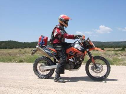
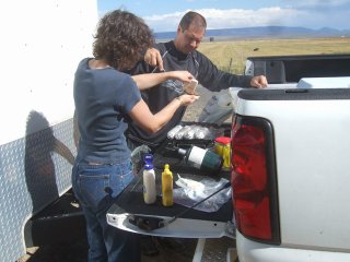
Almost ready....
The roadbook comes as 3 strips of tulip diagrams per piece
of A4 paper, these need to be cut, and taped end to end ; so 1 A4 peice of
paper results in a metre of roadbook instructions. For the 4800 odd miles there
are 94 meters of roadbook to cut and tape together !! The roadbook is then
mounted in a roadbook holder, with two knobs for rolling the roadbook forwards
or backwards to see the directions for the trail.
The roadbook contains a rolling mileage, so that you know how far the next
junction is - this means if you have 'wrong slotted' (gone the wrong way),
you'll know pretty quickly - i.e. if the roadbook says at mile 256 there should
be a fork in the trail, and your odometer is reading 280 miles, then you have
done something wrong. At this stage, you need to back track to the last known
good junction, set the odometer back to the last known mileage reading, and try
again. Usually a rally trip computer is used for this - and you can set the
computer to increment or decrement the mileage, or manually wind back the
mileage. These computers are quite expensive (several 100 £), and will be a pain
to mount on the bike with limited tools, so I've bought a mountain bike
computer - this will be simple to mount, tiny, and will allow me to manually
set the mileage. It doesn't have any decrementing features, so I'll just have
to be accurate with my navigation !!
I will also have GPS backup, which will contain the waypoints for the trail.
I'm not sure how accurate these waypoints will be - they were created by Doug
by following the roadbook on Google Earth, and entering the waypoints into Google
Earth at the junctions - respect !!!!!!
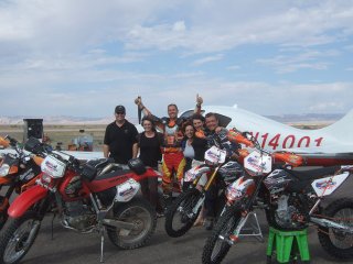
So, I fly out tomorrow to Phoenix, Arizona to meet Phil - the guy we met when
we were offroading in Russia last month. He and some of his buddies are going
to join me on the transamtrail.
In fact plans have changed a little;
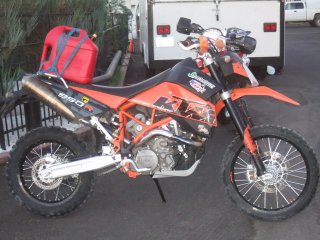
Originally I was going to do the trip solo, and intended to buy a Kawasaki
KLR650 to do the trip - this choice was based on the fact that the bike (as
standard) had a large tank range, and good load carrying capacity. The KLR was
always going to be a plodding lump, but it would be fine for the job.
Phil, then said he would like to join me, and his choice of bike was a KTM 950
Super Enduro !! He also said is brother was likely to join us in a backup
truck, and would carry luggage, fuel, spare tyres, etc, etc.
Knowing this, I decided that the KLR would be the wrong bike, so I called Phil,
and he very kindly offered to let me ride one of his enduro bikes - a CRF or a
KTM ( I can't remember which he said, as I was too excited by the news to
recall what he said on the phone!!).
I received an email from Phil last night, inviting some of his friends to join
us on the trip - he has 5 bikes (!!), the backup truck, and his private plane
to fly his buddies in from Arizona to whereever we are on the trail, so they
can join the ride for a few days.
This got us thinking... and after a couple of emails, Caroline is now going to
join us for a week - hopefully for the Colorado and Utah sections. She'll fly
from Heathrow to Phoenix, then get collected and flown to (hopefully) somewhere
near Trinidad, Colorado.
Then she can either ride with us (if her wrist has repaired after an operation)
or drive the backup truck.
Best get back to that damn roadbook.....
Aug. 10th, 2007
Ready to go....
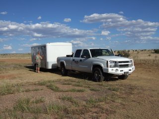
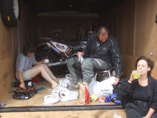
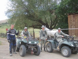
After arriving in Phoenix, Arizona on Tuesday night,
Wednesday morning Phil and I were collected by John (Phil's brother) and Randon
(from Hawaii) in the pickup truck and trailer.
Phil had a bit of business to attend to on route, so we left early (6am) from Phoenix, and headed to Santa Rosa, New Mexico. Whilst Phil did his business (!)
we borrowed the Hummer from the airfield, and headed up to the ranch they are
developing - remote and beautiful.
After a quick bite, we continued East for an overnight stop in Amarillo, Texas.
Mileage: 740 miles
Another early start (6am - and an hour change due the time zone) and we headed
from Texas into Oklahoma, then through Arkansas, for an overnight stop in Memphis,
Tennessee. And, no, we didn't see Elvis - I think he lives on a council estate
in Essex anyhow !
Mileage: 7xx miles
This morning whilst I was watching the news/weather, I found it amusing that
the weatherman were hoping for a break in the weather - praying that it would
_cool_ down !!! It is currently 43degrees !
After changing the 4 tyres on the trailer (canvas showing!), and picking up a
mobile phone charger (mine is only 240V), we continued the slog east.
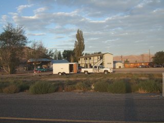
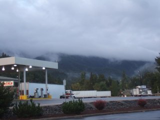
Just arrived at Columbia, Tennessee - ready for the start of the trail. From
recent reports, it appears that the first 2 days are largely tarmac, and as it
would mean travelling a further 500 -odd miles east, we (I) decided to start
the trail here.
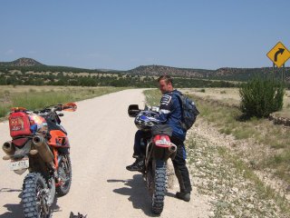
So, the plan for this evening is to get the bikes out of the trailer, get mine
fitted out with the roadbook holder, and enduro computer, and then have a
little practice to see if we can meet up with the support truck.
Randon, is driving the support truck, and by all accounts has only just passed
his driving test in Hawaiii, and has only been living in America for 4 weeks -
so is about as familiar as I am with the American road networks !! So the plan
this evening is to se a couple of test waypoints, and we'll travel on the
trail, whilst Randon travels on the tarmac, and see of we can meet up !!!
Fingers Crossed...
Aug. 12th, 2007
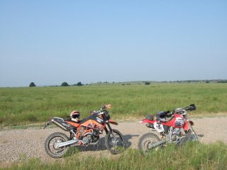
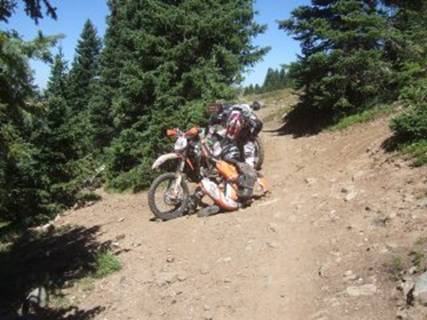
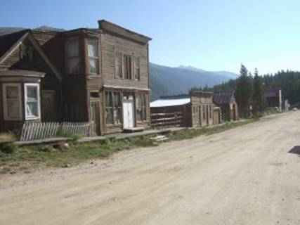
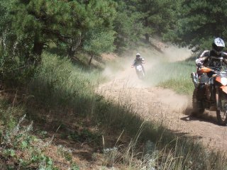
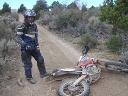
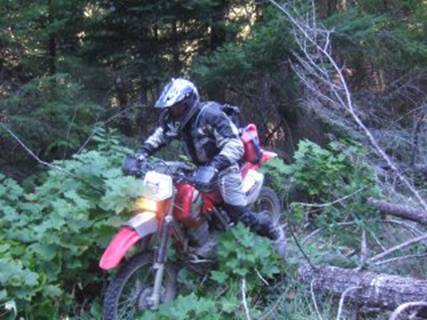
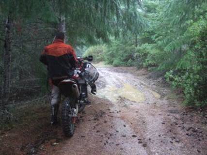
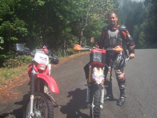
Tennessee day 1 - chicken killer... (Columbia to Selma)
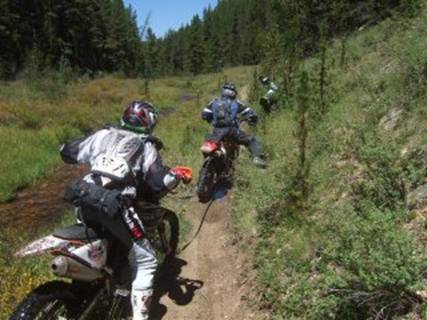
Day one was always going to be an easy ride - many of the
trails have been 'upgraded' to road :-( But for me it was a good
test of navigation - 250 miles of road book with the GPS as a reassuring
backup.
Things got off to an interesting start, 10 miles in whilst looking at the roadbook,
I felt a thump and the handlebars twisted slightly, looking back I saw a load
of airbourne whiter feathers and a chicken body on the road :-(
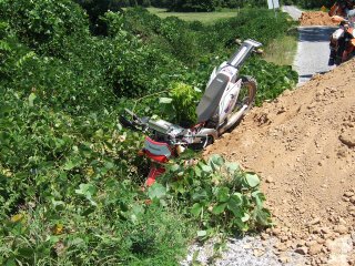
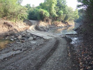
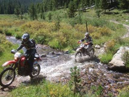
A slippery river crossing got the better of Phil, as he played skimming stones
with the KTM :-)
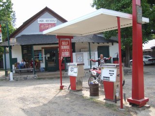
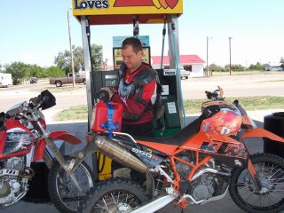
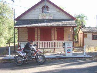
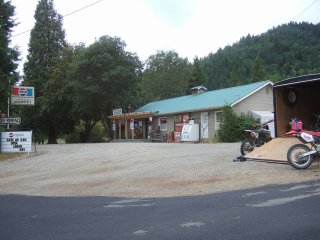
Running fairly low on fuel, we came across 'Olive's Post Office' (the
rusty fuel pump on the right didn't look to hot, but the left one pumped fine).
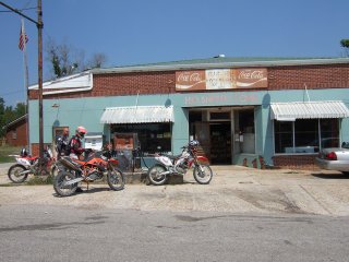
Whilst sitting in the shade with a coke we were entertained by 2 locals
transporting a goldwing:
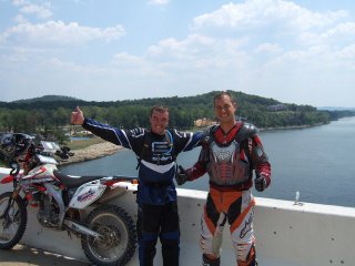
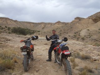
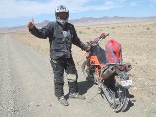
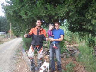
The trail then crossed the Tennessee River where they tried to get me to pose
for a photo like an American;
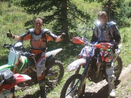
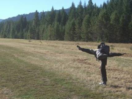
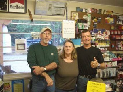
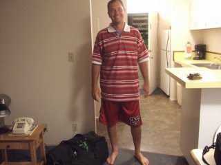
So here we have a typical one thumbs up...
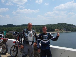
And a more committed TWO thumbs up!!
Oh, and one thing - the Honda CRF450's in the US, don't come with electric
start - so Phil and John are constantly taking the mickey out of the 'english-girl'
who can't start his bike :-(
Mileage: 250
Temperature: HOT (over 42degrees)
Photos here
So, tomorrow we head out into Mississippi.
Aug. 13th, 2007
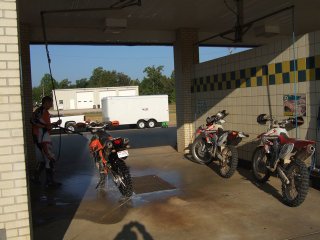
Day 2 Mississippi (Selmer to Helena MS)
Sunday morning started off with a trip to the car wash !! I didn't think the bikes looked dirty - but Phil assured me that they were !
Once off on the trail we headed for the Tennessee-Missisippii border
The days riding was again pretty much road (quite monotonous) and gravel
road (which was good fun), with a couple of memorable moments;
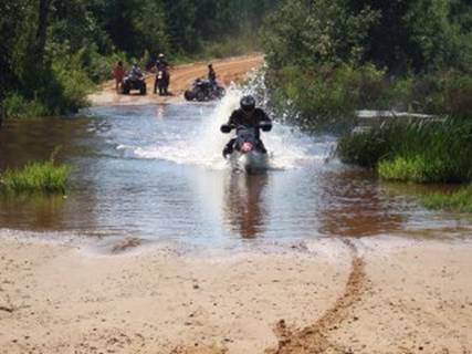
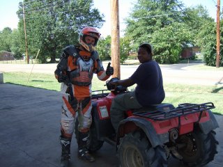
Firstly the creek crossing - I was daft enough to ask the locals on the quad
how deep the crossing was (after the crossing he shouted in a southern drawl -
"damn me that was deeper than I thought"
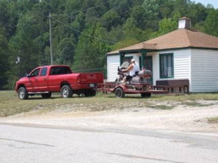
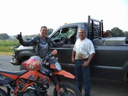
Then when running low on fuel, we met a kid on a quad who was good enough to
take us off the trail, to the fuel station;
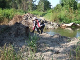
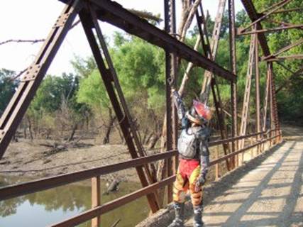
There were several 'bridge out' crossings that we continued through apart
from this one, which got the better of me !
Mileage: 240
Tomorrow, we hit leave Mississippi and head into Arkansas
Aug. 14th, 2007
Day3 Into Arkansas (Helena to Clinton)
Last night we stayed at the Capri Island Casino, on the
banks of the Mississippi River, and as usual asked someone where they would
recommend we eat for dinner - this time we asked a cop who was sat in a lay-by
chatting on his phone.
His recommendation was Kelly's, a diner up the road past the disused cotton
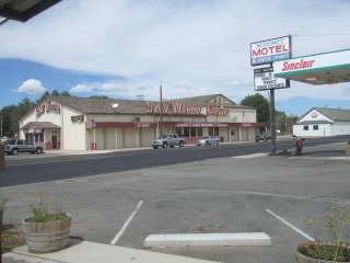
mills. The diner was more of a transport cafe, but that's fine.
This morning didn't start off too well when neither CRF would start :-( So, we
swapped my navigation equipment from the CRF to the backup XR bike, and John
drove the truck.
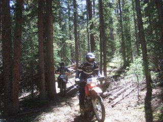
Out on the trail, most of the morning was spent riding through mile upon mile
of cotton fields; we passed a tiny airstrip with an impressive crop duster
aircraft. I always thought they were small planes, but like everything else in
this country, it was LARGE.
The trails were pretty much the same as yesterday, so only one photograph for
today's entry - the bridge was definitely out for this swamp crossing ! Phil
was trying to persuade me to jump it, using the dirt ramp to the left of where
he is checking the depth!! At this stage, the only thing that came to mind was
a mixture of the 'General Lee' from the Dukes of Hazzard and Burt Reynolds in
the Canonball Run !! eedless to say, I used my brain, and found an alternative
route around ;-)
Aug. 15th, 2007
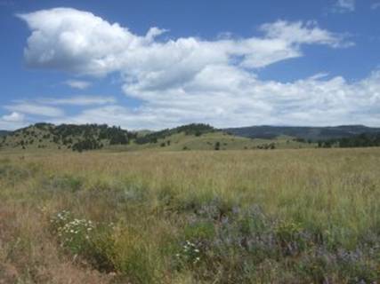
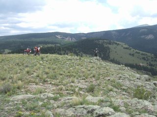
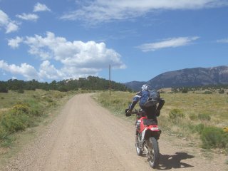
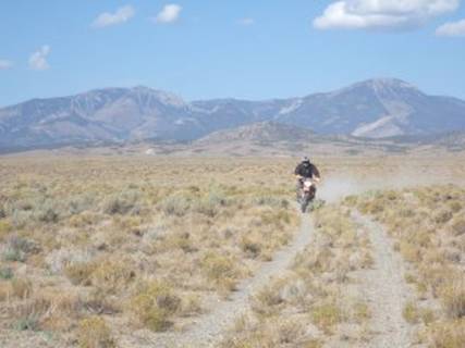
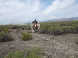
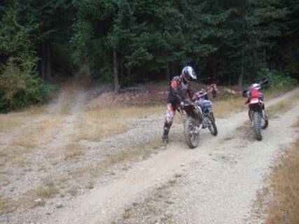
Day 4 Arkansas - BEARS AHOY !!! (Clinton to Alma)
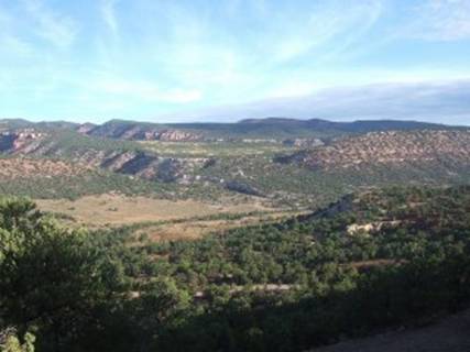
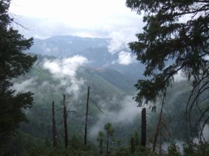
Today was exactly what I had imagined the TransAmTrail would
be like - 10% tarmac, 80% gravel, 10% jeep track, together with great scenery
and fantastic people. Today was superb fun.
We left Clinton, Arkansas, and headed into the Boston Mountains in Arkansas,
where we ducked and dived, and wiggled and weaved around the mountains, in and
out of the forest. After 100 miles, we stopped at this great little town, which
had this single fuel station/grocery store/cafe/tool shop. In the photo you can
probably just see 'Junior' (left), and Jim (right) on the porch to the store -
we sat and chatted with them for half an hour whilst waiting for the lunch
special to be cooked. They told us all sorts of tales of dare; from building
the roads through the forest, to discovering Marijuana plantations in the
forest, to making moonshine whisky. A truely entertaining time - it certainly
backed up my thoughts from the mornings ride, where I half expected the General
Lee to be broadside around the next corner, with 'Sheriff Rosco P Coltrane' in
hot pursuit :-)
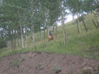
The afternoon ride for me was just the best !!!
I came around a corner in the forest to see a brown bear scurry off the trail,
and into the forest. I was probably within about 15m of the it !!
Whilst coming down from the excitement of almost bumping into a brown bear, and
within 45 minutes, I rounded another corner and came up upon a black bear !!!
This one was even closer, probably 5 m away. Awesome.
Tomorrow we head into Oklahoma.
P.S. It's still damn hot - 42DegC
Aug. 16th, 2007
Day 5 Into Oklahoma (Alma to Bartlesville)
No photos today.
100 miles of fairly interesting gravel trails across from Arkansas, then 150
miles of gravel straight-90 degree turn-gravel straight-90 degree turn etc etc
A classic example of the American town-grid network gone mad in the country !
Mealtimes were entertaining today - pizza lunch sat with a bunch of workmen,
one of whom asked if we had "run out of things todo" when we
mentioned what we were doing. Fair point I guess :-)
Arriving in Bartlesville, Oklahoma, scorched, hot and sweaty we stopped at
Sonic (a drive in diner) for a slush drink thingy, and met a lady who had
visited London in 1977 - she proceeded to chastise Phil for not warning me
about the scorpions and snakes in the desert.
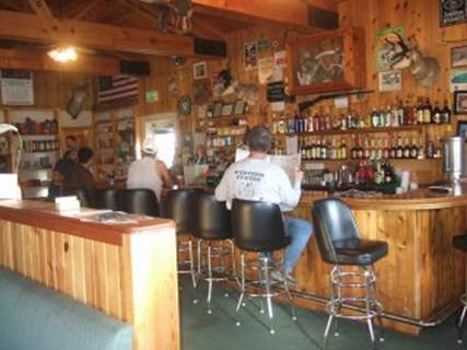
Then a steakhouse for dinner tonight, which had to be the friendliest place
around - the owner ended up getting the whole staff out of the kitchen, the bar
and the diner for a group 'thumbs up' photo !
I'm currently setting myself up for 550 miles of more of the same grid-type
trails across Oklahoma - let's hope I'm wrong
Aug. 17th, 2007
Day 6 Oklahoma - floods and high plains (Bartlesville to Alva)
Well, I was wrong !
I was expecting a boring day of straight lines, instead we had a superb
mornings riding, met some great people, saw some fab scenery (and then went in
a straight line for 60 miles on gravel :-( )
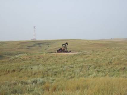
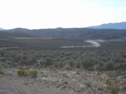
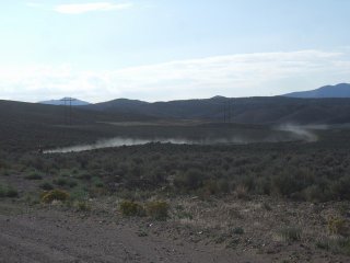
On the vast majority of the mornings ride we saw hundreds of 'Nodding Donkey'
oil pumping units - they were everywhere. We stopped at this one for a photo:
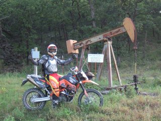
The Ken turned up - to check if we were stealing oil !!
- a very friendly guy, who told us about the floods in the area, and that they
had only receded 2 weeks ago ! He also told us about a city in Kansas (about
100 miles away) which suffered bad flooding - unfortunately this town was home
to an oil refinery - he estimated that 3/4 of the town would be bulldozed !!
After riding through the wetlands, for a few miles, the flood water line looked
high on the trees, but it was only when we got to this bridge that the extent
hit home - you can see the current water level, and the debris lodged on the
bridge (in fact there was debris on the very top steel!!)
Again, on this water crossing you can see the depth - glad I wasn't here 2
weeks ago..
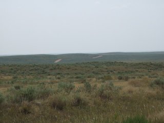
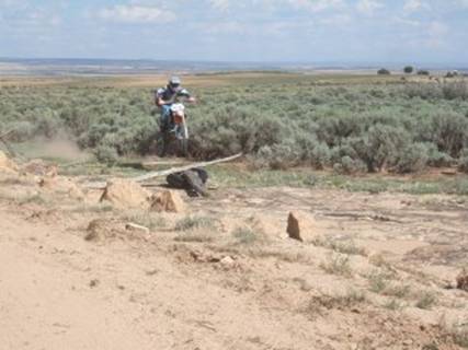
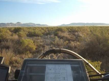
Then we hit the High Plains of Oklahoma - the vastness was incredible.
Nodding donkeys were common place.
Aug. 18th, 2007
Day 7 into Kansas (Alva to Liberal)
Around 1500 miles completed - approx 3300 miles to go !
Currently staying in Kansas after a long haul across Oklahoma (still got to pop
back into Oklahoma tomorrow, then touch a corner of New Mexico, then FINALLY
Colorado :-))
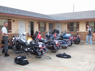
Last night we met up with some Danish guys who were riding Harley's from
Florida to California - they thought we were 'tough' for riding on dirt bikes.
There then followed a, 'you're tough', 'no-no, this is tough', 'you wanna see
tough' type conversations (we listened), but then I mentioned Doug's solo
effort, and they all agreed ' that's tough' :-) At least we got them to agree
:-)
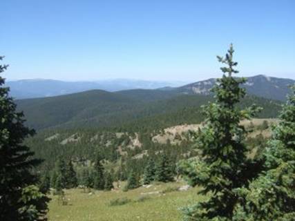
The high plains of Oklahoma offer amazing views,
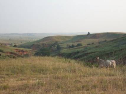
The whole of the high plains for miles and miles, were occupied by cattle and
'nodding donkeys'.
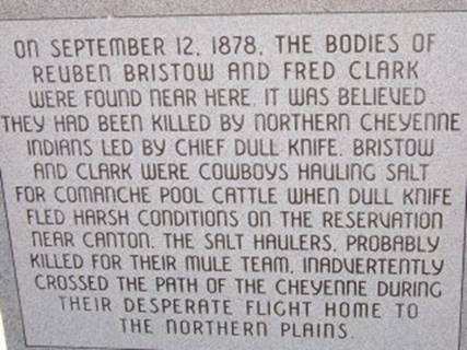
On the trail we came across a cowboy grave:
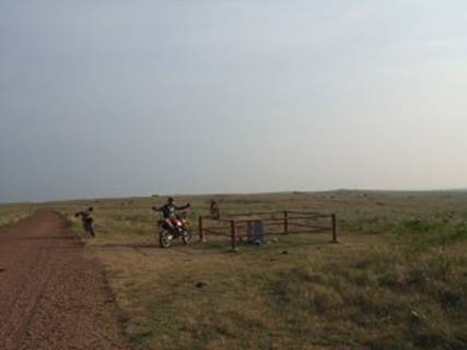
The new tombstone read:
and what could be the original:
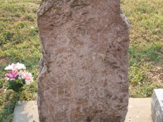
Which seems to read "CowBoy and SalHall Killed by Indians"
Aug. 19th, 2007
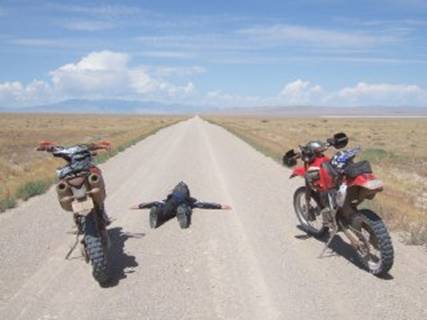
Day 8 New Mexico into Colorado (Liberal to Trinidad)
Today started with more monotony with straight Oklahoma farm
trails - BUT this was broken up by a bit of road jumping, and some wildlife
interaction (Prairie Hare, Tortoise and Snake)
Fuel stop and lunch was at Keyes - population 500 - one garage selling lunch
but no fuel, one diner - closed, one fuel pump - open (keys held by the grain
co-operative across the road!)
Open fuel station:
The town centre:
After lunch, I had a quick check of the maps - it looked like 150 miles
(approx) to the overnight in Colorado - we knew the bikes could do 100miles to
a tank, but were not too sure how much further they could go !
After chatting to a guy in Boise City (population 1483), who told us there was
nothing between here and Colorado - we decided we needed auxillary tanks:
Entering New Mexico ;
Phil was lucky to get across the heavily guarded state line with his home made
bomb;
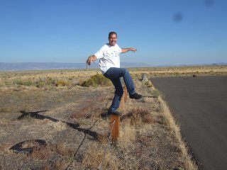
And finally, a quick photo to show what a short-arse I am (oh and great scenery
of New Mexico High Plains (6000ft))
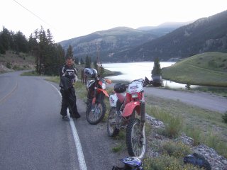
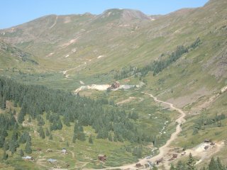
Aug. 20th, 2007
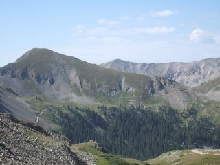
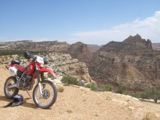
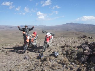
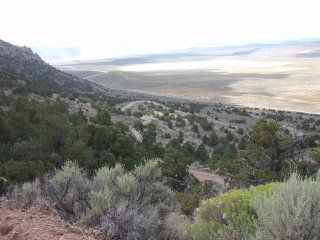
Day 9 Colorado - (Trinidad to Salida)
Today was a fairly long ride - approx 270 miles, but the
scenery was so good in the Colorado Rockies, that the time just flew by.
In fact the scenery sidetracked me enough to have an 'off' - no damage done.
All day today was spent above 7000ft ! The highest we hit was somewhere about
10,000ft - the bike was struggling a little !
A few selected photos from the day (check out my flickr
page for the rest)
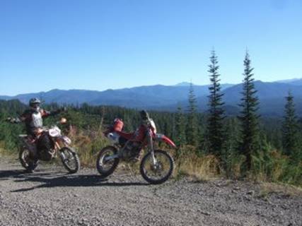
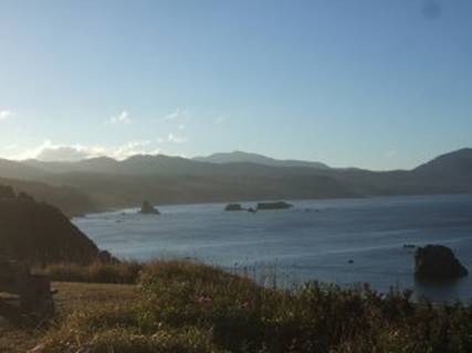
La Veta airfield at 7000ft in the Rockies
Riding in the rockies
The 'plateau' at 9000ft
And finally, my wildlife photo of the day
Aug. 21st, 2007
Day 10 - a day off in Colorado (Salida)
Today was a day off.
In the morning we went whitewater rafting in the Royal Gorge on the Arkansas
River in Colorado - twas great fun.
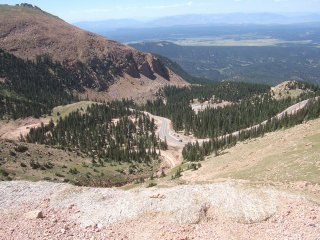
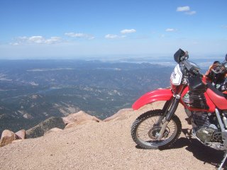
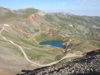
In the afternoon we headed off towards Colorado Springs, to ride up Pikes Peak.
This is really amazing, you can only get this in America - the highest mountain
around - 14100 feet, and what do you get right at the summit ??? A car park !!!
But that does mean, that there is an amazing part tarmac, part dirt road all
the way to the top - starting from around 7000ft, the 19 mile drive took us 25
minutes - and we stopped a few times for photos.
They have a race from bottom to top and the
quickest guys complete it in 10 mins!
This is the road up;
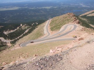
and at the top
Aug. 22nd, 2007
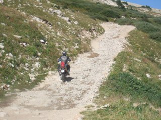
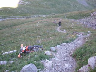
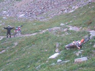
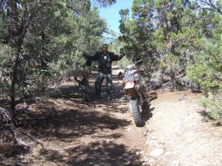
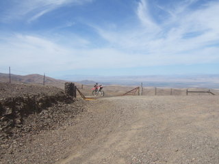
Day 11 Colorado single track (Salida)
Another day off !!
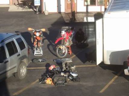
The mileage had played havoc on the tyres, and we were due for a day in the
mountains on single track, so at 6am we started changing tyres - and a
result - not one pinched tube!!
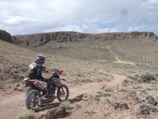
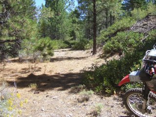
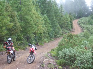
If you were wondering what single track is, here are a couple of photos of the
climb up the mountain.
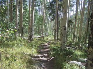
The climb was pretty difficult, for three main reasons; 1) the altititude meant
the bike didn't carburate cleanly, which meant it either chugged or rev'd - ie
the throttle was like a switch, 2) the alititude meant I got tired quickly, 3)
I'm crap at riding - the two photos don't do the climb justice, the certainly
don't call this the Rockies for no reason !! The climb was certainly rocky -
and it was a long climb!
As we were on single track for the day, Phil took out his new KTM 450 for a
play, unfortunately, it wasn't jetted for the alititude, and it behaved badly.
First we tried adjusting the airscrew;
The view from the top;
After adjusting the airscrew, the KTM still wasn't happy, and the constant
clutch slipping burnt the clutch out - so what followed was an enjoyable 2 hour
tow over single track to get to the highway.
Here Jon shows an alternative strap tieing method:
The _looooong_ tow:
and it wasn't easy
After 2 hours, we got to the highway - to find a locked gate! This was chained
at both ends, so we couldn't even lift the gate of the hinges. So,,,
Anyway, and awesome day out - fantastic trails and amazing scenery - thanks Jon
for taking 2 strangers out for a days riding.
Now we rejoin the TransAmTrail - we continue west towards Utah
Aug. 23rd, 2007
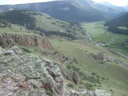
Day 12 Mountain Lion Ahoy !!!!!! (Salida to Lake City)
We finally left Salida - it seems like we have been there
for a week !
Last night Jon kindly invited us around to his house for steak and beer - oh
and a game of shoes (flinging horse shoes at a pole in the ground)
We left Salida and headed back into the mountains.
It was cold, very cold;
First stop was a rather poor ghost town called St Elmo;
We headed upward towards Hancock Pass (12125ft) - an interesting rocky trail;
then across to Tomichi Pass (you can just see it on the side of the mountain)
One route down from Tomichi Pass, we stumbled across a Mountain Lion crossing
the trail !! I must have been around 20m from it. It was about the size of a
small alsation dog, so I guess it was fairly young.
Looking at the GPS route, I attempted a short cut, following an interesting
trail. The short cut got us very close to the trail we wanted to be on - it's
just that we were about 500ft to high ;
Aug. 24th, 2007
Day 13 Colorado - dicing with the Colorado 500, and riding with the Pro' (LakeCity to Monticello)
Stayed in Lake City, Colorado - a very strange little town -
up-and-coming, but currently not quite there !
There was no WiFi in the motel, so we ended up camped out in the local gas
station with an ice cream, whilst on t'internet.
Whilst there the owner was telling us about a break-in he had recently had - a
bear had broken into the store and gorged itself on sugar, pancake batter, and soda
! He was saying that a late frost had reduced the amount of berries available
in the forests, hence the reason the bears were venturing into town. He also
mentioned a guy had recently been chased down an alley be a bear, and had
escaped by getting into an unlocked car !
Whilst wandering around town (we had arrived early after the ride from Salida),
we spotted the visitor centre, which gave advise on dealing with bears - one
note was not to sleep in the same clothes you cooked dinner in !!!
Today we were due to meet a friend of Phils in Rico (80 miles away) between 9
and 10am, so it was an early start - we left just before 7am. It was cold - Randon (from Hawaii) was acting like an extra from 'Cool Runnings' (the Jamaican
Bosleigh team at the winter olympics).
Within about 3 miles we stopped to put on some extra layers of clothes, and a
quick warm of the hands;
We were soon out of the shade of the rockies, and starting to get warmed up on
climb to the Cinnamon Pass. On route we decided to head into the America Basin
- the trail said it was closed, but as before we ignored this helpful advice
and continued on....onto a goat track - a steep, switchback goat track.
This proved a little too much for the bikes - we were at 12500ft and my bike
wouldn't rev due to the altitude. Phils worked ok, but the 400lb bike was a bit
of a handful ;
Unfortunately he was pinned under the bike after this fall - and I selfishly
dropped my bike to run to the rescue (I wish I'd got the camera out first !!).
It was only 20m or so uphill, but at 12500ft and wearing offroad gear it felt
like a mile run !!
So, we retreated and headed for Cinnamon Pass instead - fantastic scenery.
Here we bumped into the first of the "Colorado 500" riders - some sort
of 5 day trail ride in the Colorado Rockies.
We then headed over some amazing mountain side trails, towards this Ghost Town
(California Glutch)
Then over another 12000ft pass - California Pass;
After 80 miles of the above amazing trails we finally made it Rico a little
late (10:30) to meet Steve and Denise - had a quick bite to eat (somehow took a
couple of hours!!), and then continued on the trail - a couple of great passes,
and some fun in the woods:
On route into Utah, Steve decided that he'd have a play off trail;
He managed to burst both front and rear tyres in this little playpen :-)
We then continued into Utah - Steve riding behind me on two flat tyres and
pulling endless wheelies. He may be a pro-rider, but I'm sure he must have
learnt something from me - I'm just not sure what ;-)
Perhaps I'll teach him this trick;
Aug. 25th, 2007
Day 14 Into Utah (Monticello to GreenRiver)
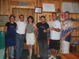
Last night we had dinner with a few of Phils friends from
the area (well one drove 4 hours for dinner!!) which was a real laugh but also
quite surreal - "Are you doing the X-Games this year?", "Nah -
they've asked me to race XYZ instead" :-)
This morning we left Monticello, and nipped back into Colorado before heading
towards Utah for real. The approach was via a wooded hill, which seemed to be a
fairly small climb to around 10,000 feet. Then on the descent we got our first
glimpse of the amazing sandstone synonymous with Moab.
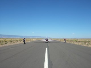
Today was our first rendezvous with the airplane, to pick up Michelle from New
Mexico, and drop John off.
Whilst at the airport, I had an interesting conversation with a chap who was
boarding the aeroplane in the background;
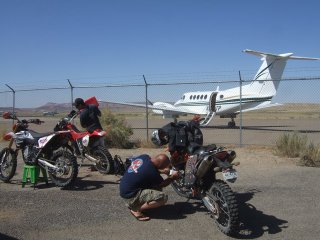
He started by complimenting the array of bikes that we had, he also mentioned
he was a dirtbiker, and had a Honda CRF. Then he happened to mention he was the
the Governor of the State of Utah.
We had a bit more of a chat, then he disappeared on his way. After relaying the
story, I was suitably chastised by the others for not getting a 'thumbs up
photo' for Phils website
I have since tried to recover the situatiuon by emailing Jon Huntsman Jr at the
Utah Governers Office.
After a tasty Italian lunch, we then disappeared off to Green River - with
Michelle and Phil 2-up !!
Aug. 26th, 2007
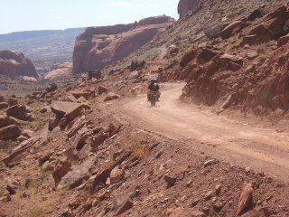
Day 15 - Moab
Another day off - I guess we are slacking !!
After collecting MIchelle off at Moab airfield and riding the trail to Green
River, Phil discovered he had to return to Arizona for some business - so that
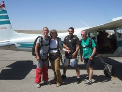
left Michelle, Randon and I with a day in Moab.
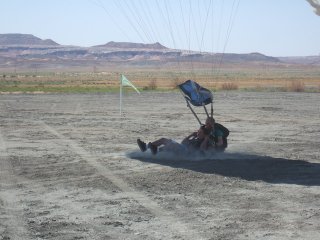
Over a beer, we decided that a skydive would be the best use of a day off
(don't all the great ideas appear over a beer?)
The skydive was over Moab, jumping from 11000ft from ground - which is 16000ft
above sea level :-)
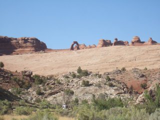
After lunch we headed off to do some touristy stuff in the arches national
park, so here is the obligatory 'Delicate Arch' photo (taken from a distance, cos
it was too damn hot to walk far)
Aug. 27th, 2007
Day 16 Utah Aeroplane rendezvous (Green River to Richfield)
Today's ride was the first without a decent lunch stop, so
we headed off to the grocery store to stock up, then headed off to Moab
airfield to meet Phil, Margie and Caroline. Arriving at the airfield, we
couldn't see the aeroplane anywhere - a quick phone call later, and we
discovered they had landed at Green River - so we gave chase, and quite quickly
found the airfield in the middle of nowhere!!
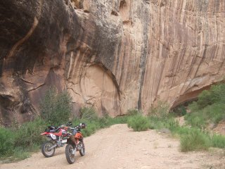
We very quickly hit some great 2-track through river-beds, and up on top of
canyons - awesome riding , and super scenery.
The trail passed under and over the Interestate 70, sometimes through small
tunnels (bike room only), and sometimes under spectacular bridges;
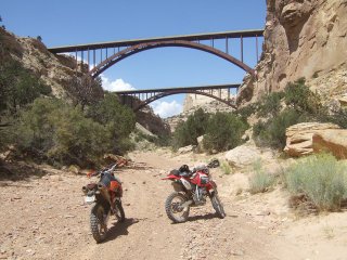
The trail then headed away, towards Cat Canyon - awesome.
The trail then dipped into a dry sandy river bed for the next 30 or so miles,
very twisty and great fun - the whole time we kept one eye on the weather -
there was thunder and lightening in the not too distant - and we were very
aware of the flash flood potential.
After meeting up for lunch on the roadside, we had a very leisurely ride on
easy trails for the next 100 miles to Richfield.
Aug. 28th, 2007
Day 17 - Utah to Nevada (Richfield to Baker)
This morning, the weather looked a little dodgy;
After the rain last night - the trail was sticky and slimy - but great fun.
Climbing high above Richfield - the views were amazing;
We then entered an ATV park - but this was nothing like an ATV park in the UK -
we travelled for almost 30 miles on ATV trails - tight and twisty with great berms
on most corners. Much of the trail was on the sides of the hills you can see in
the picture above . Fantastic riding !!!
There were no towns between the source and destination, so we met up with the
chase truck for a welcome picknik - Bar-b-q steak in the back of a trailer :-)
Following the fun of the mornings ATV trail - we then endured 80 miles of
straight gravel over the salt lake - I think it proved too much for me;
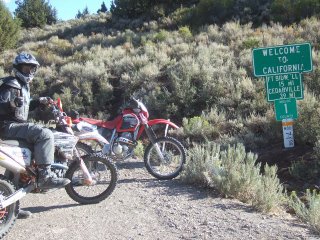
Eventually we got to the Nevada stateline;
Once in Nevada, we checked out the motel (singular) in Baker, and decided to
truck on to Ely.
Aug. 29th, 2007
Day 18 Double 'em up (Baker to Eureka)
Today we planned to double our money - we were going to do 2
days in 1 - 350 miles !!!
The first 30 miles were dual track, with plenty of washouts - we averaged
30 mph, which was good going:
Then we were very quickly onto single track, which was fab fun, but was having
an effect on our average speed. The trees were close together so there was
plenty of tree banging with handlebars, upper body and helmets :-)
The trail finally opened up to desert again, which meant we could get cracking.
It was still dual track, which meant concentration was still required due to
the washouts and the odd hidden bend....
No harm done ( apart from a bruised knee!)
We were still going well, and on target for getting the 350 miles completed
when disaster! Phil ran out of fuel, 15 miles short of the fuel stop - in the
middle of nowhere !
In fact we had just crested a summit at 9000 ft, and I'm sure I had checked
behind to see he was there ! On the descent, whilst negotating some rolling
rock hairpin bends, I checked again - no Phil !
I backtracked to the summit - nope. I descended again, this time checking all
the turn offs - nope. I ascended, this time looking over all the cliff edges to
see if I could see a tyre mark or remenants of a bike ! At the summit I left my
rucksack, just incase Phil had ventured off and was also trying to locate
me !
Within 300 yds I found him !
The plan was then for me to go and get fuel and then return to top him up.
All this messing around wasted almost 2 hours so the double up day was no
longer viable :-(
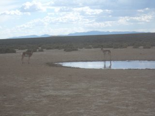
Back on the trail again, we came across a watering hole where some antelope
were drinking;
The trail then got really fun - a 6 mile dash across the plains, following only
cattle tracks - so this was a case of merely following the GPS heading :-)
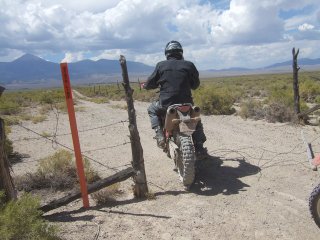
Unfortunately, I was having too much fun, and made another navigation/rider
error - the cattle track had opened up to a jeep trail, and we were approaching
the turn waypoint. I was focusing on the GPS and roadbook, and completely
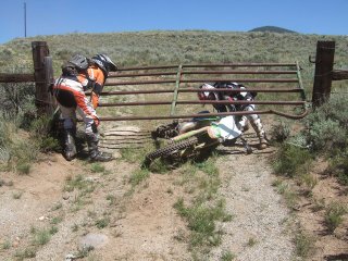
failed to see a barbed wire fence-type gate across the trail - similar to this one:
I'm not sure who won this battle ! The fence took me down, but once Phil had
untangled me from the barbed wire, the majority of the wire had
been broken by the impact - so I'm taking the win :-)
If enough hadn't happened already today, the heavens then opened !!
So another 20 miles across slippy slidy goo whilst trying to avoid bushes and
rocks!
All in all, an adventure of a day. The final mileage? 250 to Eureka, Nevada.
And, just to prove that the experience has taught us nothing - we are going to
try and double up again today - Eureka, via Battle Mountain to McDermitt - approx
280 miles let's hope it's less dramatic.
Aug. 30th, 2007
Day 19 Nevada - a doubler ?? (Eureka to Battle Mountain)
So, we were going to attempt a double day again. Why ?
Because we wanted to push ourselves :-)
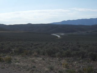
We set off just after 7am, and got cracking - the following sequence shows some
great riding across the plains;
Even though we were pushing along - we still had a chance to have a chat to
these guys who were out hunting for deer with bows;
We arrived at Battle Mountain on time at 11:30 - after 140 miles leaving us
plenty of time to complete the remaining 150 miles to Oregon - things were
looking good !!
Unfortunately, we had a fewof issues; 1) the rear brake pads on the KTM were
down to the metal 2) all the tyres were nearing the end of their life 3) the auxillary
2 gallon fuel can we were carrying had tried to escape its moorings a couple of
times, and had been swinging near the (hot) exhaust pipes 4) Phil had some
business to attend to.
So, foiled again !
We are now currently sat in a motel room in Battle Mountain, Nevada phoning
around all the motorcyle dealers in Nevada and Idaho trying to locate brake
pads. Fun, fun, fun.
At least Caroline managed to rendezvous with the aeroplane, so Margie and Randon
could return back home.
Aug. 31st, 2007
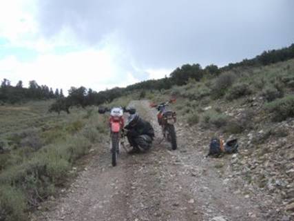
Day 20 Some minor issues (Battle Mountain to Denio Junction)
Well, we tried to double up again !!
We left Battle at 6am, and to try to reduce fuel stops, strapped a 5 gallon
tank to the KTM;
The initial going was single track, which was awesome fun, and we even managed tp
keep up a fairly respectable average speed;
Refueling took place after 120 miles, at the summit of the highest peak in the
area ;
We were easily on schedule - averaging 40mph :-)
Then a minor problem, whihc was due to turn into a major issue !
The KTM suffered a rear puncture - I had a puncture repair kit., but no
spare tube - we had forgotten to pack it. On initial inspection, the tube had
actually shredded ! So we had to options; leave the bike where it was, or try
to ride it to the nearest road (which was about 25 miles away).
Here is a video of the
ride to the road.
After about 10 miles, all was going well, and we even managed to stumble across
a rancher, who could confirm that we were heading in the correct direction to
the nearest road - I had a GPS direction for the road, but no detail of the trails
!
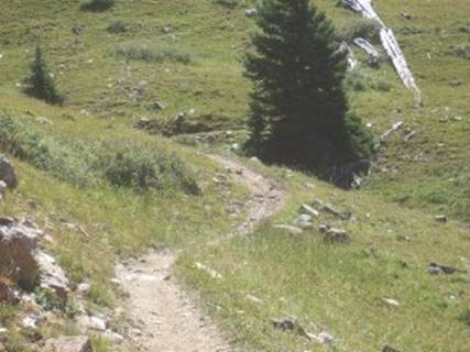
The trail towards the road took us over windy gap - which offered panoramic
views of the area;
We had almost reached the road (still in the middle of nowhere) when the KTM
finally had enough of riding on a flat rear tyre;
From here we tried to phone Caroline, who was waiting for us at Denio Junction
- 70 odd miles away (by trail). - but there was limited cell coverage.
We decided to try to get to the nearest town , 2-up on the XR !
We arrived at McDermitt - which for a town had a casino (it is Nevada), a fuel
station, and a shop;
We couldn't phone Caroline directly ( as she had not phone service), so we
tried to get the phone number for the fuel station she was waiting at -
directory enquiryies had not numbers for a gas station, an airfield, a motel,
or any shop in Denio Junction, where she was waiting !!
We then resorted to our backup plan - phone Teresa (in Arizona) and let
her work her magic !!! She managed to obtain a phone number for Denio Junction
gas station, and the owners there tracked Caroline down (who was owl spotting !
and chatting to some local minors!).
Caroline then set off for McDermitt - some 150 miles by road.
We consoled our selves in the local snack shop :-)
Whilst waiting, Doug, who's bike we had seen the night before, and we suspected
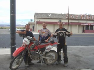
was doing the transam trail, showed up at the fuel station;
Caroline arrived within 1.5 hours, so we set off back to collect the KTM, and
swap Phil onto one of the motocross bikes.
We eventually left McDermitt at 3:30, and had the remaining 20 miles by road to
McDermitt, and 50 miles by trail to Denio Junction.
We had strapped the 2 gallon tank to the XR, but on the trail (with the bumps)
it kept falling off the back, whih meant we had to keep stopping to strap it
back on. It was also positioned so that it stopped me sitting back to read the
GPS and roadbook - which meant it was difficult to navigate.
We must have made a couple of wrong turnings in this spaghetti junction of
trails and cattle tracks, as we eventually ended up on this tiny cattle track
beside a river, with the GPS track the other side of the rocky hill. None of
the roadbook directions were making any sense - so last resort - out with the maps
!!
I figured where we were, and tried to turn off to try to get back to the trail,
which worked surprisingly well :-)
After a few more miles, we caught up with Doug - who had been lost for over an hour
!
We rode the last few miles together to Denio - arriving after 6:30 - over 3 hours for 50 odd miles !!
By this time Caroline was back at Denio, and had made friends with enough
of the guests and locals, that we attracted a welcoming committee :-)
She had even managed to acquire the last remaning room at the motel - that the
4 of us could squeeze into.
Denio Junction is an odd little place - it's the only property for miles. It is
an airfield, a fuel station, a shop, a bar and a motel , all rolled into one. A
fantastic, and very friendly place. We were made to feel incredibly welcome
here;
Sep. 1st, 2007
Day 21 Into Oregon, and more problems !!! (Denio Junction to LakeView)
After the problems of the previous day, we decided to stop
attempting to double up (and you thought we had lost the plot!!).
Doug set off on his way, and we tidied the truck and trailer, and had a good
cooked breakfast at Denio Junction:
We had 185 miles to get from Denio, through California, and into Oregon - but
Phil was on the small KTM, and it only had a very small tank range - we though
70 miles ! So the 2 gallon tank was strapped onto the XR again, the trails
tightened into dual and single track.
After bumping around for a while, the 2 gallon tank slipped off again, this
time puncturing. So we put the remaining fuel into the 2 bikes, and set off to
the first refuelling point (a roadside meet with Caroline).
We got there ok, and decided to try to meet every 50 miles !, and carry a one
gallon tank in a rucksack !
After about 30 miles, we caught Doug up on the trail - he had suffered a
cracked subframe so we decided we would ride with him to the meeting point so
that he would be able to unload his luggage into the truck , and seek a welder
!
The mountain trail lead down to the meeting point on the edge of a salt lake;
Unfortunately , Caroline wasn't there. So we headed North on the graded road
(the direction she would have come from), after a few miles the KTM ran out of
fuel (about 55 miles - so a great tank range then !!). It was refuelled with
the 1 gallon tank - and we continued to Adel. I was sure Caroline would be
there - she only had about 70 miles to do on the road. We reached the end of
the road - which was road 35 in Nevada, unfortunately, as the road entered
Oregon - they had changed the road number to 315 - I was unsure how Caroline
would find this - she was looking for road 35 !!
Phil stayed at the end of the 35/315, and I went to Adel, which was the turn
off point from the main road. It also had a gas station - which was closed
until Tuesday -as the fair was in town !!!
The nearest fuel station was in Lakeview 35 miles away.
So, after ensuring Phil would remain at the end of the 35/315, incase Caroline
turned up, I set off for fuel. I left Phil with my rain jacket, as the a desert
storm was brewing - as it happened it did rain, but I escpaed it by being on
the other side of the hills, heading for fuel :-)
When I got to Lakeview, I phoned Teresa (our helpdesk :-) ), and it transpired
that Caroline had indeed missed the (badly numbered) junction, and had had her
own adventure, but had managed to find a local rancher, who lent her his phone.
She left a message that she would remain at Adel until 4:30 then head to Lakeview.
WIth this positive info, I refuelled, and headed back to Adel. She wasn't at
Adel, so I turned off in search of Phil. When I got there, I found the 2 of
them having a BBQ !!
After a few exchanges of stories from the day, we set off to complete the final
70 miles to Lakeview - 30 miles to Fort Bidwell, California by road and
then 40 through the forests.
Wary of the tiny fuel range (55 miles) of the KTM, we took the gallon tank and
headed off to Fort Bidwell - entering California on the way;
Arriving at Fort Bidwell, we found the gas station - closed !
We transferred the fuel from the one gallon tank and headed to Lakeview - some
beautiful trails through the forests, and we finally met up in Lakeview -
WITHOUT any further issues !!
Sep. 2nd, 2007
Day 22 Aeroplane rendezvous (Paisley)
Today was another day off (!!)
We needed to do some planning as to how we progress - the KTM 450 has a tank
range of 50 miles - and we need to complete 150 between gas stations !
Also, Caroline needed to meet up with the aeroplane, to fly back to Arizona.
We located an airfield near to Paisely - this was the best kept, most remote
air field I've seen.
Phil was to be the air traffic controller for the day;
But first, he had to limber up;
Once the plane had arrived, we had a little fun;
So, now there is just Phil and I, and a support truck !!
We've just stocked up on fuel cans, and aim to carry 6 extra gallons of fuel on
the bikes - so fingers crossed....
Sep. 3rd, 2007
Day 23 Trees, trees, trees (Lakeview to LaPine)
There is just Phil and I left - and as such, the support
truck (for the first time) becomes a pain: there's no-one to drive it!
We drove the truck to LaPine, and the plan was to ride the bikes back the 150
miles down the road to Lakeview and start the trail from there!
The first hurdle was finding accommodation in LaPine - it's Labour Day weekend
- some sort of Bank Holiday.
After trying all the motels in the area, we sat on the trailer tailgate in a
fuel station forecourt pondering our options. We decided that we would sleep in
the truck, but we still needed internet access - so the plan was, to head back
to the Best Western motel - and that I (being recognisable with my 'quaint'
accent (although Phil and his brother have been telling people "it's not a
speech impediment - it's an accent")) would see if we could use their
internet access.
Result - the receptionist remembered us, and told us there had been a
cancellation!!
So, early in the morning (6am) we strapped the 6 gallons of fuel onto the
bikes, and set off on the road to Lakeview - and boy was it cold - brrrrrr.
Once in Lakeview - after a 3 hour ride, we joined the trail - it started as
gravel road, but turned to untouched trail;
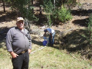
Whilst Phil was (again) retying his fuel can back to the bike - I met up with
these 2 guys, who were filling their water jugs from a spring - they had been
using the same spring (when on vacation) for the last 25 years.
As has been customary so far, we came across another road closed, and again
continued through - although my little short legs let me down on this one:
The trail then turned onto a disused railroad line for 15 or so miles, which
was great. Long sweeping gravel turns all on an embankment several meters above
the forest floor.
We had found out that the fuel station at Silver Lake closed at 3pm today (sunday) so we were racing to make it on time (if you remember, we have fuel
range issues!!).
Things were going well, until the trail turned to this;
The rocks got more and more frequent - it was like riding a ploughed field for
the next 5 or so miles - except the rocks weren't as forgiving !
We reached SilverLake an hour late - and there was no sign of anyone.
Phil wanted to keep going, but I'd been told stories by many people, that Phil
is notorious for running out of fuel. We had 50 miles by road back to LaPine -
we emptied the cans into the KTM (filling it), and put the remaining litre
(quart) into the XR.
The KTM has a 50 mile range - so made it back (just), and the XR crawled into
the parking lot after 15 miles on reserve!!
It was 7pm, and we had to move on, so we packed up the bikes and headed to Diamond
Lake where we would sleep in the truck, ready for the next day. (we will miss
out 40 miles of trail - but so be it !!)
Sep. 4th, 2007
Day 24 Horizontal trees (LaPine to Canyonville)
We spent last night sleeping in the truck, pretty much in
the middle of nowhere (well Diamond Lake) so we had a great view of the stars
in the sky, due to the lack of cloud, and more importantly, light pollution.
Last night was the first time I'd been hoping NOT to see any wildlife !!
We only had a 100 miles to complete before the first fuel station (and first
sign of civilisation), which was lucky as the fuel can for the KTM had suffered
from the being thrown from the bike one too may times!!
So, off we set, on easy gravel roads that twisted through the National Forest.
After maybe an hour, I spotted an airfield on the GPS, so we diverted to check
it out;
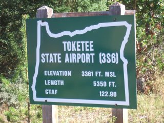
It was quite an odd site, carved into the middle of the forest - with no sign
of life.
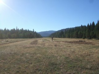
So, I attempted a grass landing;
At the airstrip, this tickled me - how on earth the pilot can spot the windsock
is one thing, but being so close to the trees renders it pretty useless;
The gravel roads continued to wind through the forest, offering great views;
We were soon to come across another road closed sign , but continued. It
quickly became clear why the road was closed - trees down everywhere;
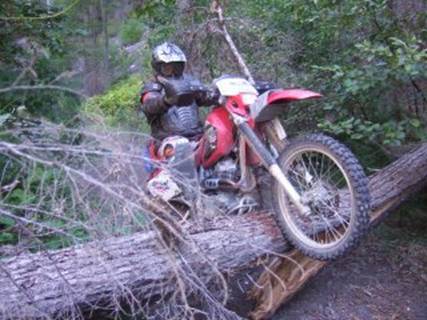
We crossed the first 10 or so trees, with varying style;
A few hundred yards further on there were some HUGE trenches that had been dug
- presumably to stop people going down the road. So we continued;
After riding, pushing, lifting and dragging the bikes over trees, through
trenches for an hour, we had only covered a mile. I walked on, and in the next
100yds I counted 18 trees over 1.5 foot in diamater criss-crossing the trail.
The trail continued for another 2 miles, and we were losing time, and wasting
fuel, so we turned back :-(
The return journey was a little easier, until the KTM refused to start at the
bottom of one of the trenches, After repeated attempts, the battery gave up -
and there was no kickstart. There was no way we could push the bike out of the
trench, as it was too steep and slippery, and was probably 3metres deep !
Out came the trusty fuel straps - this enabled us to push and pull the bike (on
it's side) out of the trench.
Once we got our breath back, we had the small task of starting the bike - we
had to push start it. This would normally be easy, but we were inbetween a deep
trench and a fallen tree, and the trail resembled a ploughed field, filled with
boulders !
We tried pushing but no good. The strap came out again, and we managed to bump
start it by towing it behind the XR.
The remainder of the route was uneventful, and we stopped at Tiller for fuel
and lunch. Tiller had one shop, with a single fuel pump.
Over a burger, we chatted to this hunter, who was out sleeping in the wild
after some deer - hopefully (for him, not the the deer), the 23rd out of the 28
big game in North America for him. He was hunting with bow and arrow, and had
been out for the last 2 weeks hunting this one animal. I asked what was his
trophy to date - the answer - a polar bear, with an arrow !
After lunch, I then back tracked 80 miles on gravel and twisty tarmac, back to
the truck, whilst Phil continued 20 miles to get a motel in Canyonville.
I then had a great drive in the trailer and truck through some great twisty
roads, with fantastic scenery - until I got held up by a biker on a Harley
Davidson. I sat behind him on some fab roads, with the 'Country and Western'
blaring on the CD player, without getting any kind of road rage. Am I becoming American
??
So.
Tomorrow, should be the final day - but it is 144 miles to the coast, and the
road route to collect the truck is even further. So there will have to be some
careful planning tonight...
Sep. 5th, 2007
Day 25 - the PACIFIC OCEAN (Canyonville to Port Orford)
The Final day - the Oregon Hills - do those clouds look ominious to you ?
Rather than ride 15 miles down the highway, we drove the truck, and then attempted to find somewhere to park up - we located a great little grocery store in Fortune Branch where the owners very kindly allowed us to park in their lot;
As we had 144 miles to do, and some past reports over the last couple of years indicated that the trail was impassable - requiring a lengthy reroute, we finally sorted out the fuel carrying on the KTM (pity we hadn't done this days ago !!)
Whilst tuning the bikes (ok, patching them up!), Don appeared to chat; (he was later to text us a particularly accurate weather report later in the day)
It was only earlier in the morning - and 'Phil from the desert' was already whining about the cold - I thought it was just like trail riding in Wales;
Whilst pulled over at the end of a trail section, we bumped into Ellis and his partner who were camping in the area - he gave us a heads-up on the status of trail riding in Oregon;
We then climbed higher into the Oregon forestry;
which offered us some great views into the valley, and over the clouds
All to soon, we climbed up into the clouds - we rode along one particular ridge for half a mile or so, and all that was beneath us on either side was tree-tops and a sea of cloud. What a shame, the view must be awesome on a good day.
All to soon, the rain started, and got heavier, and heavier. With 140 miles of forest, we refuelled under a tree;
On route through the misty forest, I rounded one bend to be confonted by what appeared the be the rear-ends of 3 horses, as they dashed into the forest, I realised that they were Elk - awesome !
We sloshed through some interesting (and slippery) ATV trails for another hour or so, until we finally descended beneath the cloud, and into sunlight;
Here's Phil trying to muster a 'thumbs-up', but is too wet to do so :-)
Totally sodden, and with the wind chilling us to the bone, we tracked onto a more direct gravel trail to the coast. With the dust finally damped for the first time in 4800 miles - Phil was finally able to ride right on my tail - which made for a great chase down the mountains, on the twisty gravel trails.
Finally we arrived at the Pacific - Hooray !!!
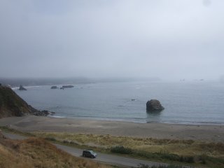
Oregon has been unbelievable - over 500 miles of forestry trails - superb!
After checking into a cliffside motel, we headed over to a local diner for lunch - ordering anything hot - soup, hot chocolate, pasta - anything to try to warm up.
After lunch (a late lunch -4pm), I left Phil at the motel, and I got back on the XR to ride the 135 miles on the highway back to the truck - and then drove the 135 miles back to the motel.
By the time I arrived (10pm) Phil had already dressed up in his party outfit;
(Apperently he had been to the only shop in town (the grocery store) that
stocked clothes, so that he had something dry to wear.)
Sep. 7th, 2007
The long drive back...
The long drive back from Oregon to Arizona is going to be a
3 day affair (just to lighten the load).
The first 100-odd miles were down the pacific highway, which offered great
views of the Pacific Ocean - I love the way the forest reaches down to the
shoreline.
We then crossed over a mountain range (dunno which one - but it was fab (well
the road was nice and twisty :-) ) ), and headed for Fresno, where Phil was
meeting up with the plane to head to Texas.
After an overnighter shacked up in a Super8 motel, and an early 03:00 drop-off at the airfield, I set off for Vegas.
On route I passed one hell of a windfarm;
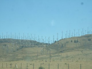
I guess it's green energy - but it's a bloody eyesore!
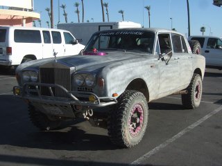
Finally in Nevada, I pulled over at Primm for a quick break, and came across
the paddock for a desert race
that is taking place this weekend.
Even the local gentry had entered in the family roller;
Right I'm off to the Casino to spend my launderette tokens that somehow never
got spent ;-)
Sep. 10th, 2007
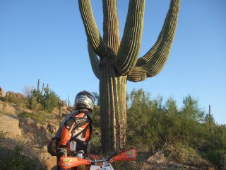
Cactus attack !!!
05:30 the alarm was set for this morning !!
Trail riding in Arizona is best done at sunrise, when there is some hope that
the temperature is below 100F!
A bunch of Phils friends turned up for a 40 mile single track loop in the
desert (and forest - but I wouldn't confuse the English readers by mentioning
forest, as I saw the 'forest' sign , but I didn;t see any trees!!)
It transpired that the guys are all motocross/enduro racers - at expert level.
I managed to keep their dust in sight (some may say binoculars were required
for this !) for the first part of the loop, but towards the end, I was
completely knackered and unable to ride even vaguely properly !
Even the scenery had it in for me - a cactus jumped out and tried to attack my
arm. I rode a bit further with my new friend, but with every bump the cactus
spikes moved in my arm causing more extreme pain (wuss!!)
The reaction is to try to pull the things out - even tho' common sense tells
you not to. Phil took pity, and pulled the main parts off me with the use of 2
sticks. Even in the swimming pool an hour later, I was still picking the spikes
out !!
Absolutely great fun and a fab ride.
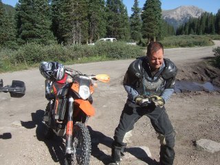
Phil sizes up a cactus;
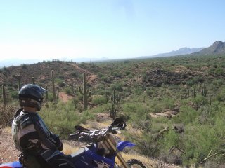
The trail heads up towards the rocks..

From here you can see the trail zigzag on the left side of the photo;
Sep. 17th, 2007
Back in Blighty
Hi !!
I arrived back in Blighty last Wednesday after a rather sneaky airline tactic -
I thought the aircraft wouldn't be particularly full flying out of America on
Sept 11th ! I was right - I had 3 seats to myself for the long haul back to the
UK :-)
As you may have noticed from the blog entries and photos - I had a great
adventure on the Trans-America-Trail - great company, great scenery, great
people, and truely great experience.
The highlights ? Well, it is very difficult to say - there were so many great
experiences, but if had to, I guess the highlights would be surprising the
wildlife (espec the black bear, brown bear and mountain lion), playing silly
beggars with the aeroplane and riding over the 14,000 ft trails in Colorado.
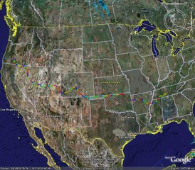
Summaries from the trip are:
photos
GoogleEarth
Track [3Mb] (get GoogleEarth)
The overview map of the trip:
So, what next ?
Well, I'm a lucky little sod - I'm off to Romania on Friday for a weeks trail
riding - I wonder if Dracula is in residence....